The Greina Tour (Greina Ebene) is one of the most classic hiking trails in Ticino. With this short text we want to accompany the hiker on his journey with a story on the geological nature of the rocks encountered.
For those wishing to learn more about the subject, an excellent cartographic base is offered by the Sheet 136 Greina of the Swiss Geological Atlas, while detailed information can be found in the works of Baumer et al. (1961), Jung (1963), Baumer (1964, GS-39), Frey (1967, NF-131), Voll (1976), Kupferschmid (1977), Merz (1989), Etter (1987), Steinmann (1994), Wiederkehr (2009) and Galster (2010a, 2010b and 2012). For any information, insights and guided excursions, you can instead contact us through the form.
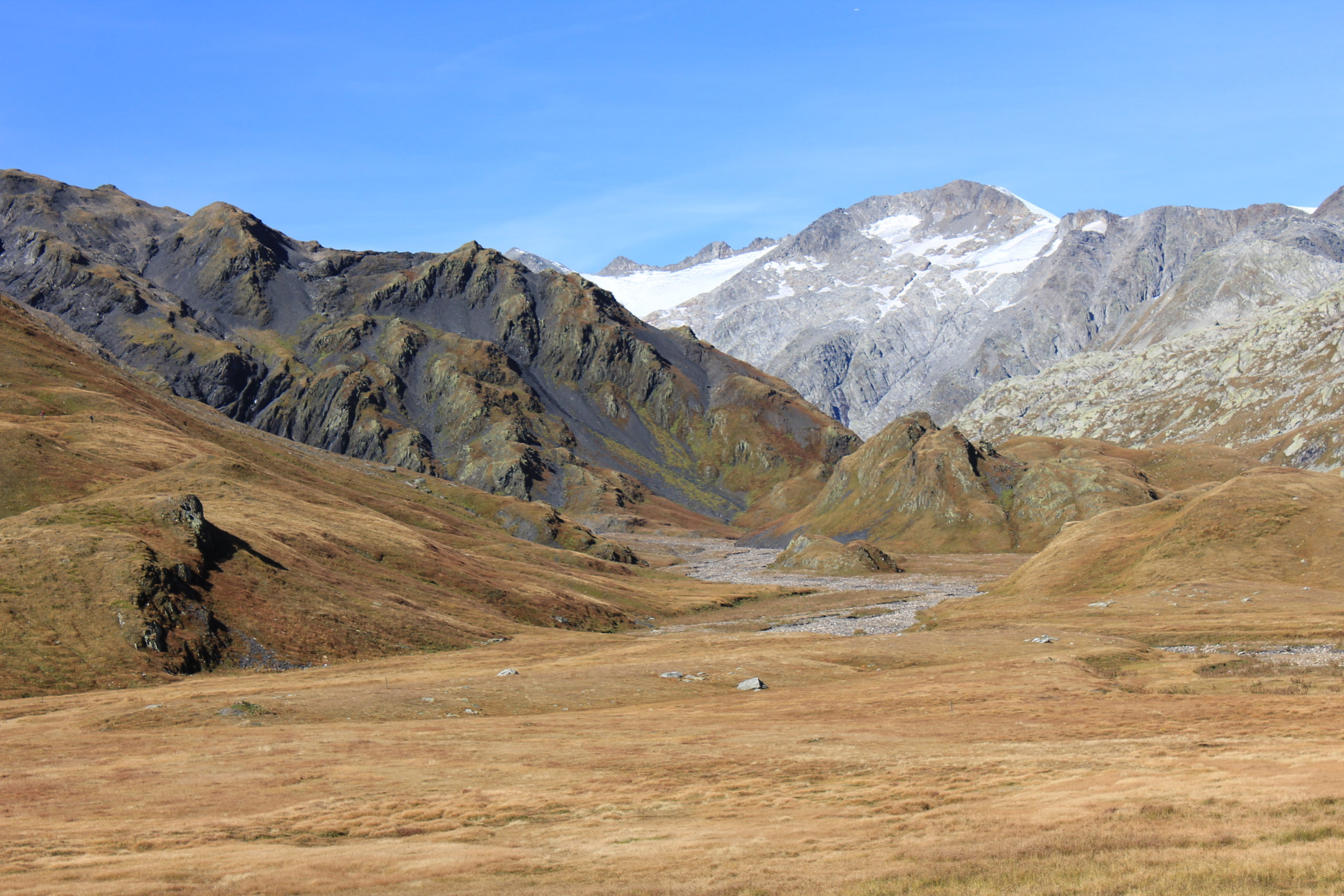
For practical reasons we will give up the initial portion of the route and will leave directly from the parking area under the _alpe di Fontana San Martino, in the high Val Camadra and we will end at diga del Luzzone (The Luzzone dam). This is because the geological formations observable during the ascent of the lower Valle Camadra they then reappear between Crap la Crusch and Alpe di Motterascio..
High Val Camadra - Piz Medel - Muot la Greina
Along the road, just above the village of Daigra, the street cross a small bridge (stop here) after which the transit is not allowed without a valid written authorization. Here, just in front of us, we have a tectonic boundary that through the Lago Retico fault divide the blackish pile of metasedimentary rocks to the south from the whitish gneiss of the Gotthard Massif to the north. The fault run from Cima della Bianca in Val di Campo up to the Pizzo Coroi in Valle Cavalasca. We can locate it in the trough of Ri di Prüsfà and of Ri di Sassina respectively to the west and the east of the observer.
The limit today appears very clear-cut, but it should be noted that its history has actually been a little more complex. The sedimentary formations to the south came to rest with a sliding movement towards the northwest on the Gotthard "massif". The tectonic thrust originally must have been somewhat horizontal or slightly sloping towards the southeast, but later orogenic movements first could fold it and then steepen it bringing it locally to be almost vertical or even to lean towards the north. Eventually the contact was resumed and remobilised by the current Lago Retico fault.
The total distance accomodated by the movement of the sedimentary pile to come to rest on the Gotthard "massif" is not known and, depending on the school of thought, varies from a maximum of a few kilometers to a few tens of kilometers. We will take up the question again towards the end of the tour, when we will arrive in the Motterascio area .For now we simply need to keep in mind that in crossing the Ri di Prüsfà we enter the tectonic unit classically called "Gotthard massif". We should also keep in mind that the contact between the rocks to the south with the rock to the north, which today seems so united, is not primary at all but is the consequence of the Alpine tectonics and the relative movements between huge rock masses (tectonic units or nappes).
The Gotthard unit
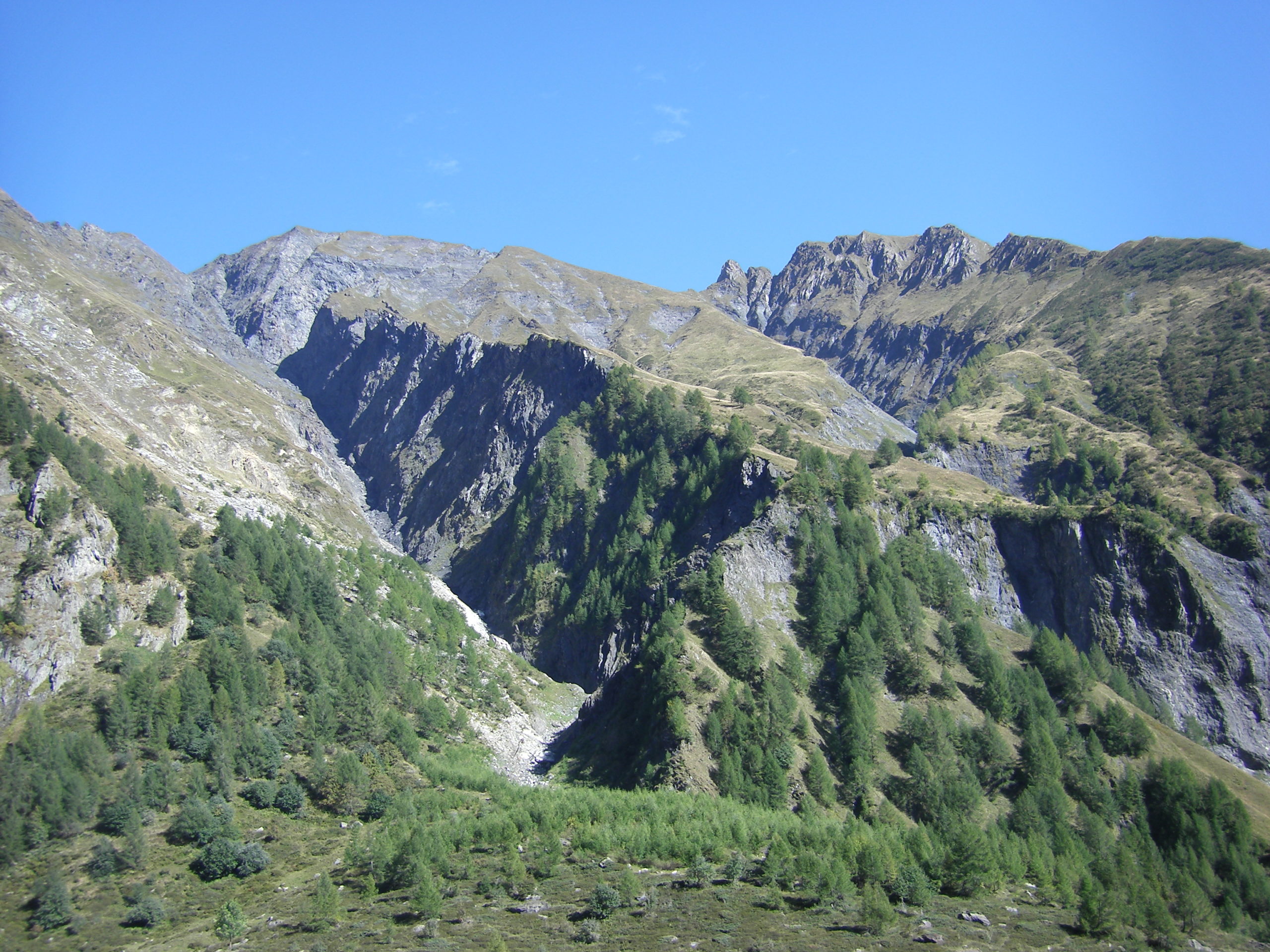
The rocks of the Gotthard "massif" will be with us up to Pian Geirett and then up, along the Brenno della Greina first and the the Rhein da Sumvigt then, up to Crap la Crusch, where turning south we will leave them behind us.
If, however, finding ourself betweenAlpe di Camadra di fuori (1745 asl) and Pian Geirett we turn our view eastwards, towards the eastern side of the valley, then we find again the blackish rocks that we had left behind crossing the Ri di PrüsfàThese rocks lie the slopes of Sassina and Marumo above 2000 asl where between the cobbles and the pastures we can see a sharply contrasting line with black rocks above and a yellowish band below. This is the exact same tectonic contact seen at the start, but here without the late disturbance of the Lago Retico fault. Now it is oriented northward with an angle that is sometimes horizontal but generally sloping from south to north.
Above the contact we can see the Jurassic rocks of the Scopi unit. These, unlike the Gotthard rocks below, lie with their youngest portion at the bottom of the pile, which support the tectonic nature of the contact. Instead below we can see some dolomites and some white sandstonesArkosispresumably Triassic (from 250 to 200 millions of years ago or simply Ma) and resting directly above the Gotthard gneiss which in turn are much older (in this case we are dealing with the so-called Streifengneiss dated at 450-430 Ma). The contact between the arkosis and the gneiss is absolutely stratigraphic and it represents one of the most revolutionary events in the geological history of the alpine region: the Triassic basal transgression .
The Gotthard gneisses have a very old origin and most of them underwent at least one orogenic cycle before the Alpine one. In the lower Carboniferous (360-318 Ma), in fact, a mountain range was erected prior to the Alps and belonged to the Variscan cycle (also called Hercynian) of which we find traces especially in France, Germany and the Czech Republic. In the late Carboniferous and in the Permian (300-250 Ma) this mountain range went against a real collapse and, in the future Alpine zone, it gave way to a peneplain. At the end of the Permian and during the Triassic the plains were flooded which allowed the formation of sedimentary deposits in the form of quartzite and arkose sandstones first and then of dolomites with evaporites. The typology of the deposits demonstrates how the environmental conditions were comparable to vast expanses in arid areas and affected by more or less persistent marine flooding, but always characterized by a very limited water column. In classical Alpine literature this type of stratigraphy is called the "Trias Germanique réduit" (Gignoux, 1950) and we can find it alongside an almost mythological geological entity that has been proposed as the southwestern extensions of the Bohemian Massif (Czeck Republic) that has been named the "Seuil Vindelicien" (Vindelician threshold). Around the threshold marine condition where more persistent and the subsidence rate was higher, which gave rise to the Muschelkak see to the north and to the Alpine sea to the south and east. The existence of the Vindelician threshold, of which the Gotthard and neighboring units must have been a sort of southern promontory, is supported by the contrast of facies and fauna between the two seas (Ricour, 1952). Today's examples of similar sedimentation can be found in the Sabkhah of the Persian Gulf, the Dead Sea, parts of the Sahara and Namib deserts.
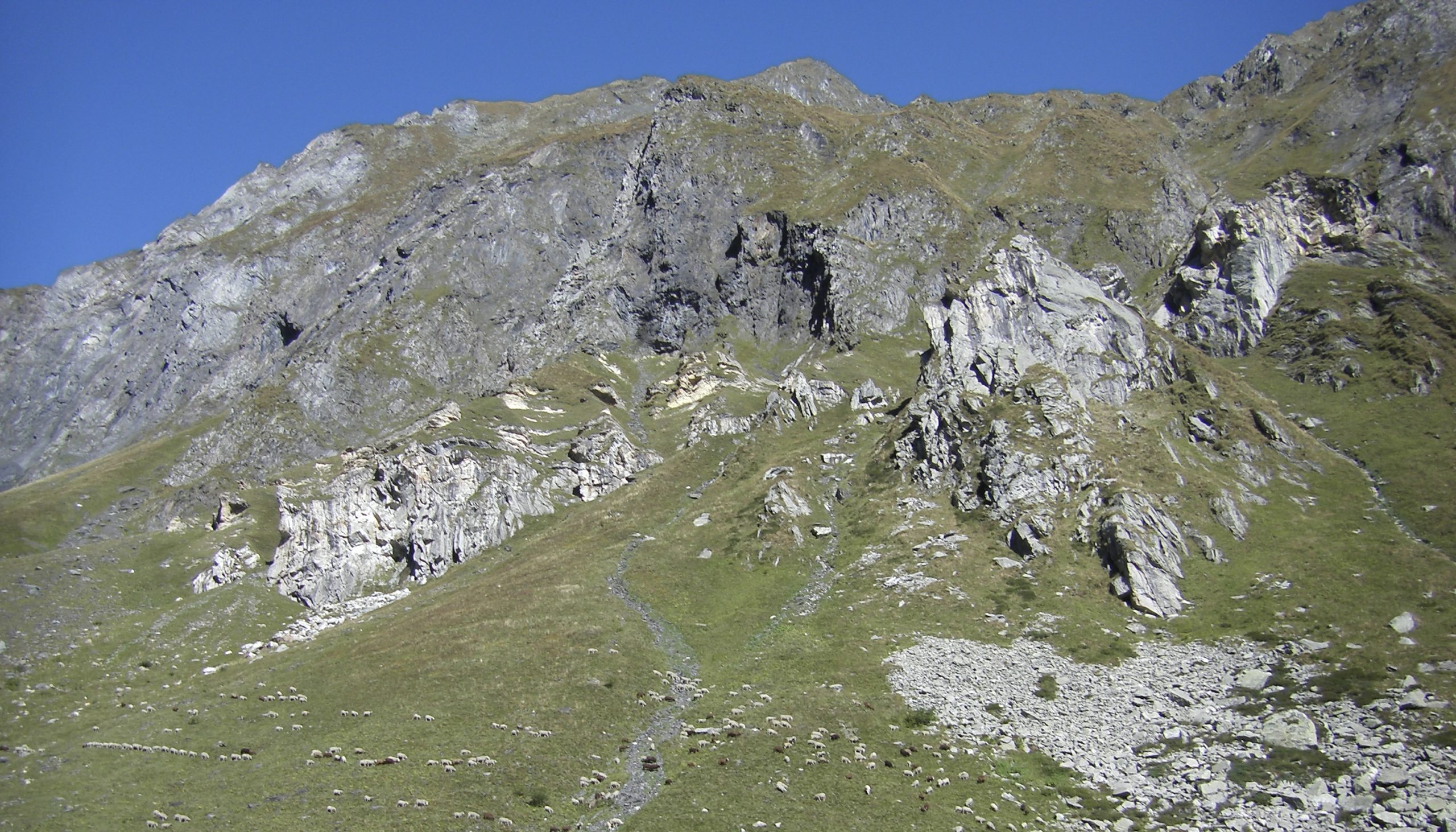
Below the arkosis, down the the river Brenno and up again until us and then higher to the Pass d’Uffiern and up to the Cima di Camadra, instead we find the already mentioned Streifengneiss. These are rocks of magmatic origin which intruded within a metamorphic complex in the late Ordovician (460-445 Ma) and early Silurian (up to 440 Ma). Today the Streifengneisses appear as rocks with light bands composed of elongated vermiculi of quartz and feldspar in a micaceous matrix. This is mainly the result of the deformation experienced during the Variscan cycle in the Carboniferous epoch (see above). A beautiful Streifengneiss complex can be observed in the roche moutonnée above the roadway between the beforelast hairpin bend (1950 asl) and Pian Geirett.
Downstream of the roadway and in the first section of the hairpin bend, we find a fine example of the metamorphic complex into which the Streifengneiss intruded. These are migmatites and micaceous gneiss with plagioclase and alkali feldspar of uncertain age but certainly comprised between the middle Ordovician to the Cambrian (540-490 Ma) and the Neoproterozoic (1000- 540 Ma).
Following the path towards the Brenno river we arrive at the white arkoses, here with quartzite sandstones and a greenish conglomerate basal part similar to the Swiss “Verrucano”. These are coarse debris formations, sometimes with volcanics, which locally filled the intramountain basins and grabens (depressions bordered by faults) existing mainly in the Late Carboniferous and Permian during and after the disintegration of the Variscan range. In the area of Greina the closest analogous complex is located between the_Alp Cavel in Lumnezia and Carpet in Val Sumvigt, where we can find the metarhyolite and the conglomerate of the Carpet slice (Schuppe).
The pathway along the Brenno takes us along the steep slopes below the Capanna Scaletta. These are partly covered by fans composed mostly of flakes and fragments of a black stone that is so reminiscent of slate. Once again we are dealing with the Jurassic schists of the Scopi unit which we will deal with later.
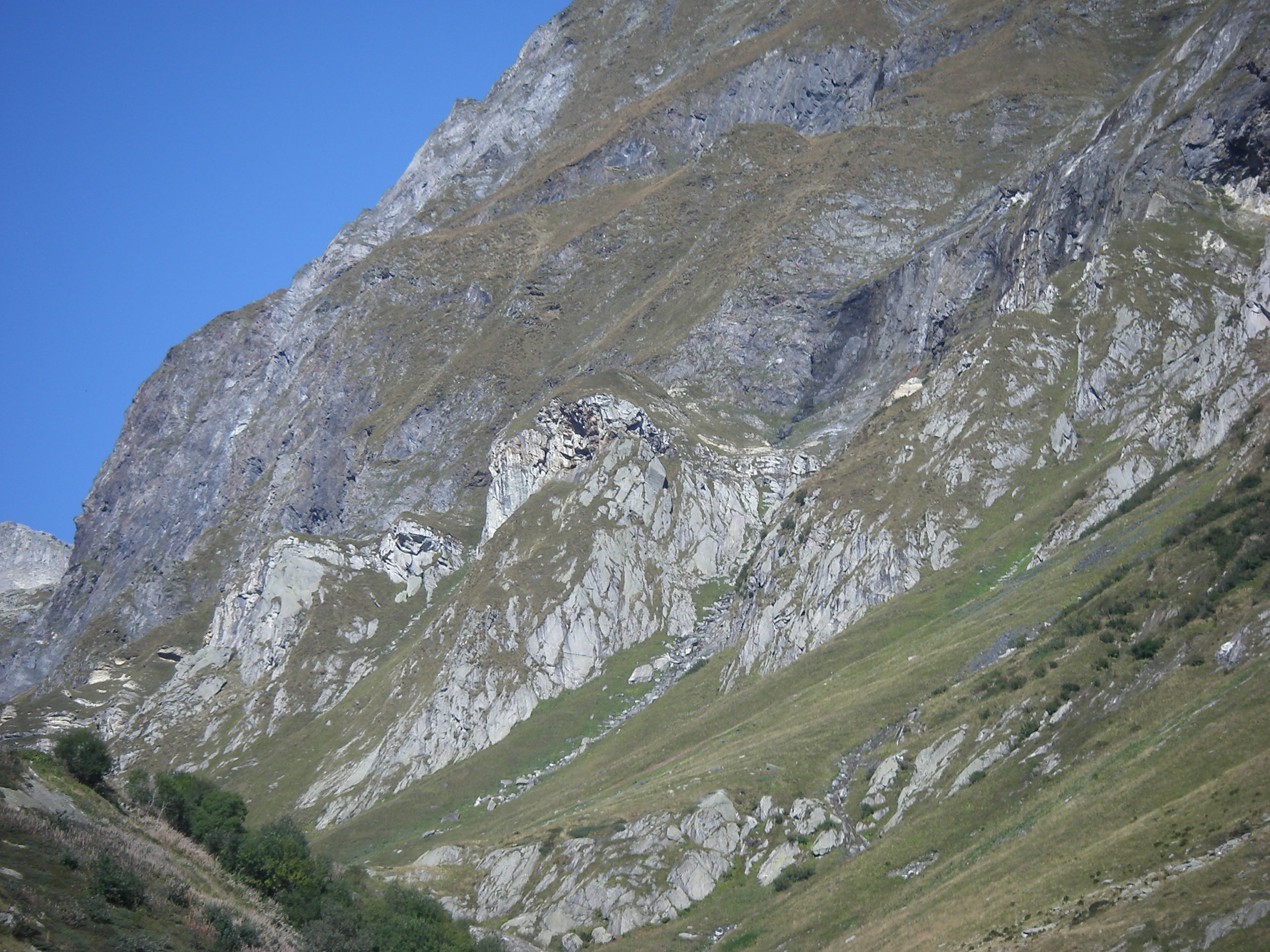
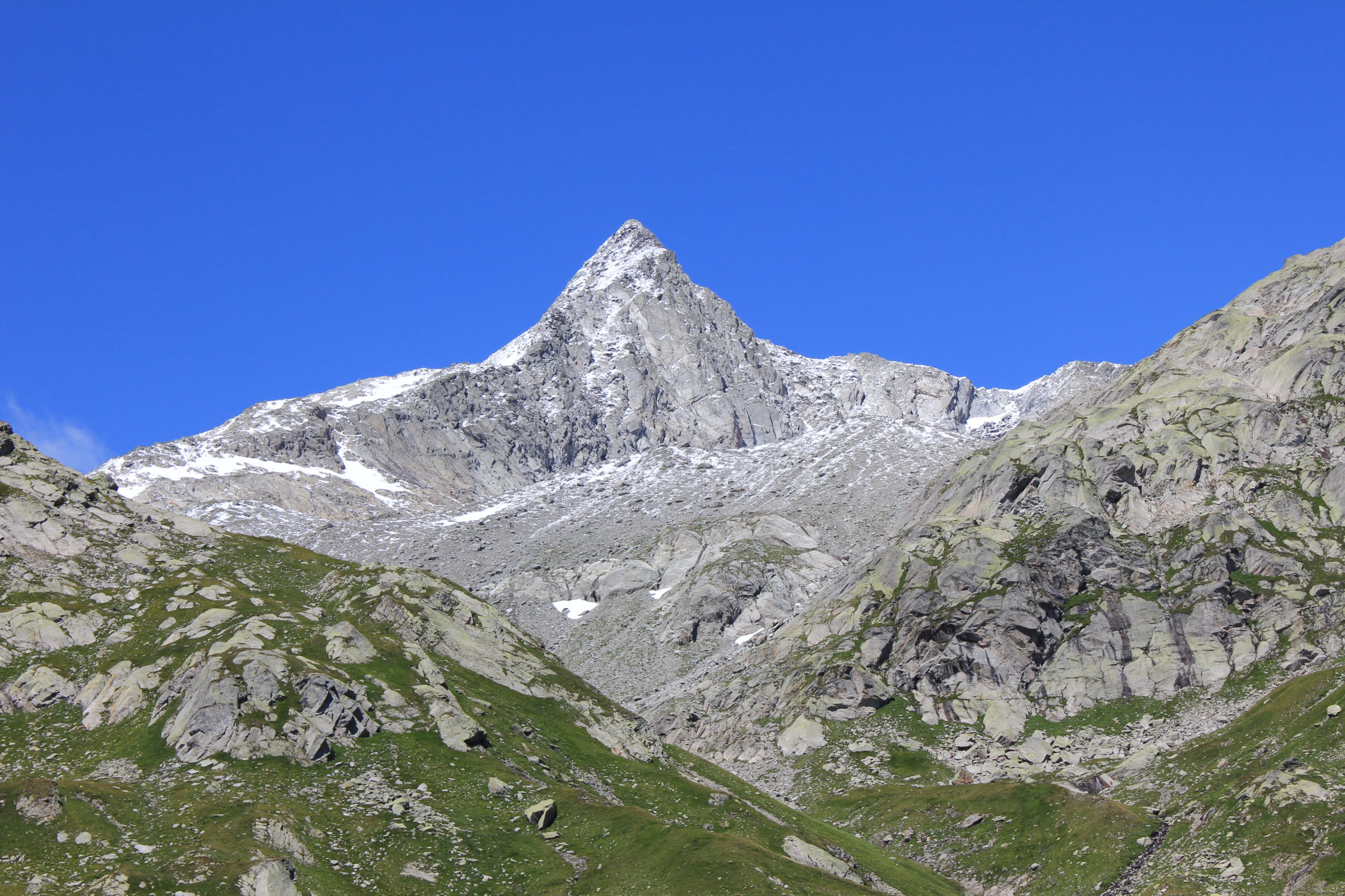
The steep but short climb towards altitude 2148 instead takes us back to the Gotthard unity with its dolomites, sandstones and finally the Streifengneiss. If we turn our gaze to the west we can admire the grandeur of Cogn di Camadra and the slopes occupied by the orthogneiss (gneiss deriving from magmatic rocks) of the Gotthard. These gneiss from the furrow of the Ri di Prusfà reach, through the Sasso Lanzone and the Cento Valli, up to the Piz Medel, then continue north-east across the ridge between Piz Gaglianera and Piz da Stiarls and finally down to Muot la Greina and Camona where they suddenly break against the blackish schists of the Jurassic age, the same we met at the beginning of the tour.
The summit of Piz Valdraus, the northernmost point of Canton Ticino, is instead of a different nature and is part of the complex of the so-called Val Nalps gneisses. Also in this case we are dealing with metamorphic rocks from the Gotthard, however, not deriving from granitoids, as was the case for the Streifengneiss, but rather from rocks of sedimentary origin. For this reason and for their "gneissic" appearance they are classified as paragneiss. The original sedimentary rock, for which the name of protolith is used, must have been rich in volcanic intercalations of a mostly basic nature, therefore influenced by magma derived directly from the earth's mantle .
A plausible scenario for the formation of this sedimentary complex with volcanic intercalations may be that of an ocean trench near a volcanic arc, somewhat like the current Andes in South America. To reinforce this scenario we find, north of Piz Valdraus and behind Piz Vigliuts, a banded complex of amphibolite with some ultramafic lenses. The protolith of this complex most likely derives from an old portion of oceanic crust (MORB) or in any case from a magma deriving directly from the partial melting of the Earth's mantle. The most likely age for its formation is the Neoproteroic period (1000-540 Ma).
The mineralogy of the complex reveals how, before the Alpine cycle, it underwent a strong degree of metamorphism dominated first by high pressure (eclogite) and then by high temperatures (granulite-amphibolite). This places the Val Nalps complex in an ante-Alpine orogenic context for which we can think of the subduction of a portion of the oceanic crust first and then of the collision between continental plates. Radioactive isotope dating of metamorphic minerals and some magmatic bodies fixes this orogenic cycle to the early Ordovician (ca. 470 Ma).
If we compare the age of the orogenic cycle recorded in the rocks of Piz Valdraus (470 Ma) and compare it with the age of the Streifengneiss (440 Ma), we have to accept that the intense deformation of the latter cannot be linked to the same orogenic cycle of the first but must necessarily be younger. We can therefore conclude that in the Greina rocks we have evidence of three orogenic cycles:
- One, the most severe, which took place in the lower Ordovician and is beautifully recorded in the gneisses of Val Nalps, can be observed on the summit of Piz Valdraus.
- A second one which is testified by the intense deformation of the Streifengneiss (440 Ma) and which is absent in the granite rocks of Piz Cristallina (see below) and in the sandstones and dolomites of Val Camadra. Therefore must necessarily be ante-Alpine but younger than 440 Ma.
- A third, the last, perhaps the least intense, is the one whose beauty we can admire. With his strength he created the Alps and in the small part of the Greina he led to the deformation of the Jurassic rocks that today we can observe upside down on the Gotthard massif.
To close the circle of this first stage, it is necessary to go back to the granitoids of Piz Cristallina, which together with those of Val Medel and the diorites of Uffiern, intrude into the metamorphic complexes of Piz Valdraus and in the Streifengneiss between the end of the Carboniferous and the early Permian (300-290 Ma). These granitoids do not show any deformation except the Alpine one, which is why the cycle that deformed the Streifengneiss has an age between 440 and 300 Ma. In other parts of the Alps this cycle, the Variscan one, could be identified in the lower Carboniferous between 360 and 318 Ma.
to be continued...09.08.2023