Geophysics
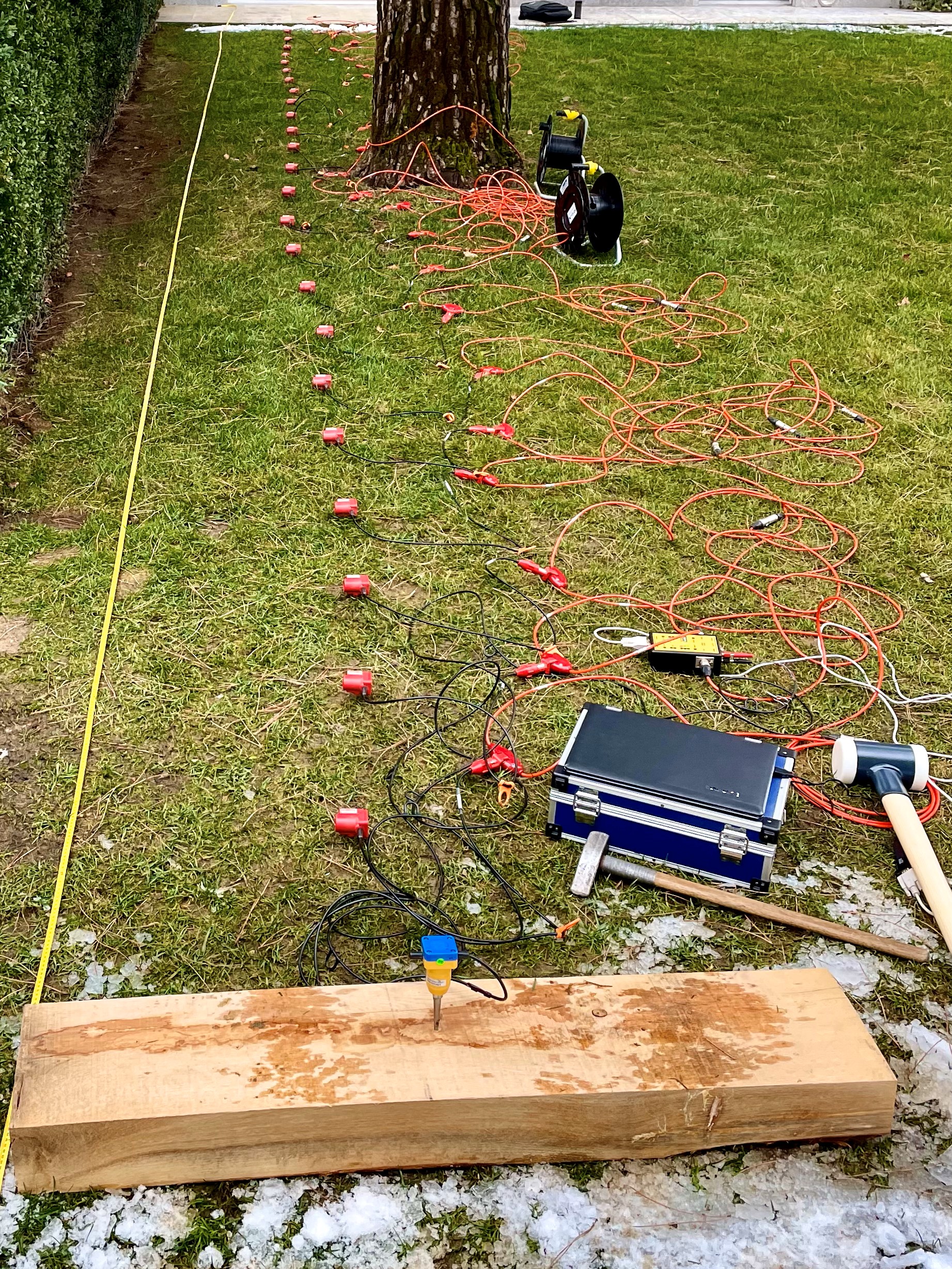
 One of the tasks of the geologist is to provide precise information about the nature of the subsoil. This information is often gleaned from historical data and from direct field surveys, such as exploratory wells and boreholes. This punctual information can be extended spatially thanks to geophysics which allows to deduce certain characteristics of the ground from its response to physical stimulations, such as vibrations (seismic), electrical impulses (geoelectric), radio waves (georadar), magnetic fields ( geodesy) or a combination of multiple stimuli (e.g.: the seismoelectric and electro-magnetic methods).
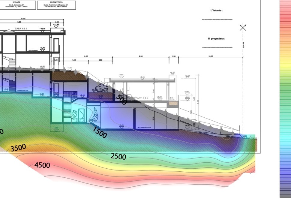
The application of suitable calculation algorithms and solving differential equations allows the spatial modeling of the results (tomography) and provides two- and three-dimensional information on the subsoil. The advantage of geophysical methods lies in an excellent cost-performance ratio, in the large spatial coverage and in the fact that they are generally non-destructive techniques, which also allows their application in urban areas.